
Search Harrison County Property Records in Order
Start with the strongest clue in hand. An address is easy to recognize. Yet it can be spelled several ways. It may also point to a mailing place rather than the parcel itself. An owner name can find a tax account. A business, an estate, or a mineral account may sit under a different form of that name. The index may hold it under that variant. The district, map, parcel, and suffix build a steadier key. That key is firm once the assessor result is in hand. Carry that key into GIS, the Clerk index, and the tax system. Do not restart with a street name in every office. That key opens every door.
The basic route through Harrison County property records is short. Locate the account through the assessor or the statewide assessment search. Inspect the parcel on the map. Query the Clerk index when a transfer, lien, plat, or estate order is involved. Check tax status with the Sheriff. A parcel record is a lead, not the instrument. The signed and recorded instrument still governs every question of title. The Harrison County property search page covers the address, name, and parcel fields in detail.
- Enter the street name or the best owner-name spelling in an assessment search.
- Write down the district, map, parcel, suffix, legal description, and deed book/page if shown.
- Open the parcel in GIS, then compare its location and map context with the assessment record.
- Use the Clerk’s grantor or grantee index to find the recorded deed or related filing.
- Ask the Sheriff or Clerk for the current tax or copy route when the online record is incomplete.
The Ownership Search is the county's local entry form for owner and parcel clues.
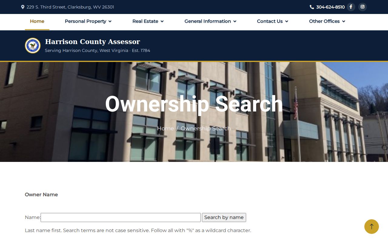
Have a name or parcel number in hand first. Compare surface and mineral accounts separately. The statewide West Virginia assessment search screenshot shows the broader street and parcel modes for a first lookup.
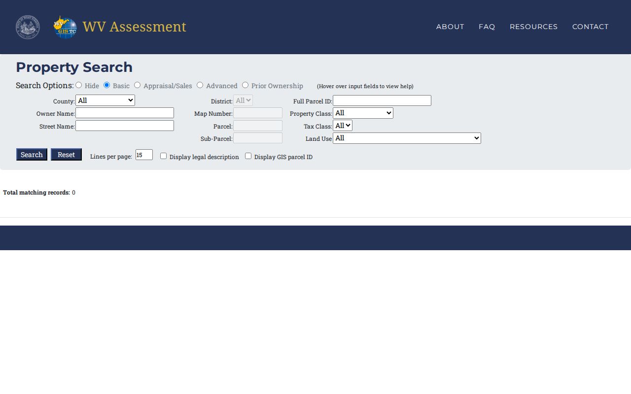
Match the statewide result's situs address and parcel key against GIS before trusting it. Then carry the account into the deed and tax records.
Harrison County Property Record Offices
Four county functions anchor the local record trail. They trade parcel clues freely, but their records are not interchangeable. The assessment record describes the tax account. The Clerk's index points to legal instruments, the Sheriff collects the tax, and the map service places the parcel in space. A city permit adds a fifth set. A court case, meanwhile, can explain a sale, a dispute, or an estate transfer inside Harrison County.
| Record desk | Record focus | Best first route |
|---|---|---|
| Harrison County Assessor | Owner name, surface and mineral accounts, assessment | Ownership Search |
| Harrison County Clerk | Deeds, liens, plats, estates, marriage and land books | County Clerk land-record page |
| Harrison County Sheriff | Tax collection and tax-record links | Sheriff and tax office |
| County GIS | Tax parcels, mapping districts, rights-of-way | GIS hub |
Two offices share the Clarksburg courthouse annex at 229 S. Third Street. The Clerk answers at 304-624-8674, Monday through Friday, 8 a.m. to 4 p.m. The Assessor’s main line is 304-624-8510, with separate numbers for real estate, minerals, homestead, personal property, and taxes. Call ahead to confirm counter hours, fees, and copy rules before making a trip.
The Sheriff’s tax-collection and civil-process offices use the courthouse address. The Sheriff’s main numbers are 304-423-7705 and 304-423-7700. The county does link an online tax search, but the county publishes no stable public URL or result format for it. For a missing bill or delinquency detail, ask the tax office for the correct account and record year rather than trusting an old link.
A record held by a public body can also come through the West Virginia FOIA process. Name the record with reasonable detail and send the request to the agency that keeps it. The law allows five business days, excluding weekends and legal holidays, for copies, an inspection arrangement, or a written denial. A custodian may charge actual reproduction cost but not staff search time.
Note: The parcel number is the clearest bridge between Harrison County’s tax account, map layer, and recorded deed.
Types of Harrison County Property Records
One parcel can carry several distinct records. The assessor's owner and value fields support tax administration. They do not establish every legal interest. The deed names the parties and describes the land. A mortgage, tax lien, easement, or court order can affect the property without changing the surface owner of record, so read each record for the question it answers.
The Clerk's index reaches past ordinary deeds. Its families include Deeds, Liens, Miscellaneous, Estates, Other, Birth, Marriage, and Death. The book list also names plats, surveys, road records, releases, redemptions, tax liens, judgments, and reports of sale. That breadth explains the surprises. A property inquiry in Harrison County can surface an estate filing or a release instead of a deed. Filter by instrument and index role first. A name match is not always a transfer.
- Grantor
- The person or entity that gives an interest in a recorded instrument.
- Grantee
- The person or entity receiving that interest.
- Parcel
- A mapped tax account used to identify land in assessment and GIS records.
- Plat
- A recorded drawing that lays out lots, blocks, or other land divisions.
Harrison County Land Book Records
Harrison County land books come in two runs, 1796–1910 and 1911–1935. That is only the start. The book selector reaches further. It lists deed books, survey books, and plat cabinets. Road records, judgment volumes, tax-lien books, releases, and sale reports appear alongside them. Marriage bonds from 1784–1850 and order books from 1848–1853 are named there too. That widens the same search well past deeds.
District labels help. Clark points to Clarksburg, Simpson to Bridgeport, and Eagle to Lumberport. Elk points to its own district, and Union to West Milford. Treat these labels as search clues, not proof of today's city limits. The online index is a doorway, not a full shelf. Its result grid carries fields for index role, image, status, date, document, book and page, pages, subdivision, name, cross-date, and instrument. No stable live result appears, though. Image cutoffs and copy prices stay unpublished online. When an older entry is missing, ask the Clerk for the book itself. You can also request the Land Book Index numbered 1–93. Staff can confirm physical location and microfilm holdings.
The Clerk's land-record page gathers the portal, the fee schedule, and index resources on one screen. The historical book choices are displayed there. Open the Harrison County Land Records Inquiry to see the book and instrument choices firsthand.
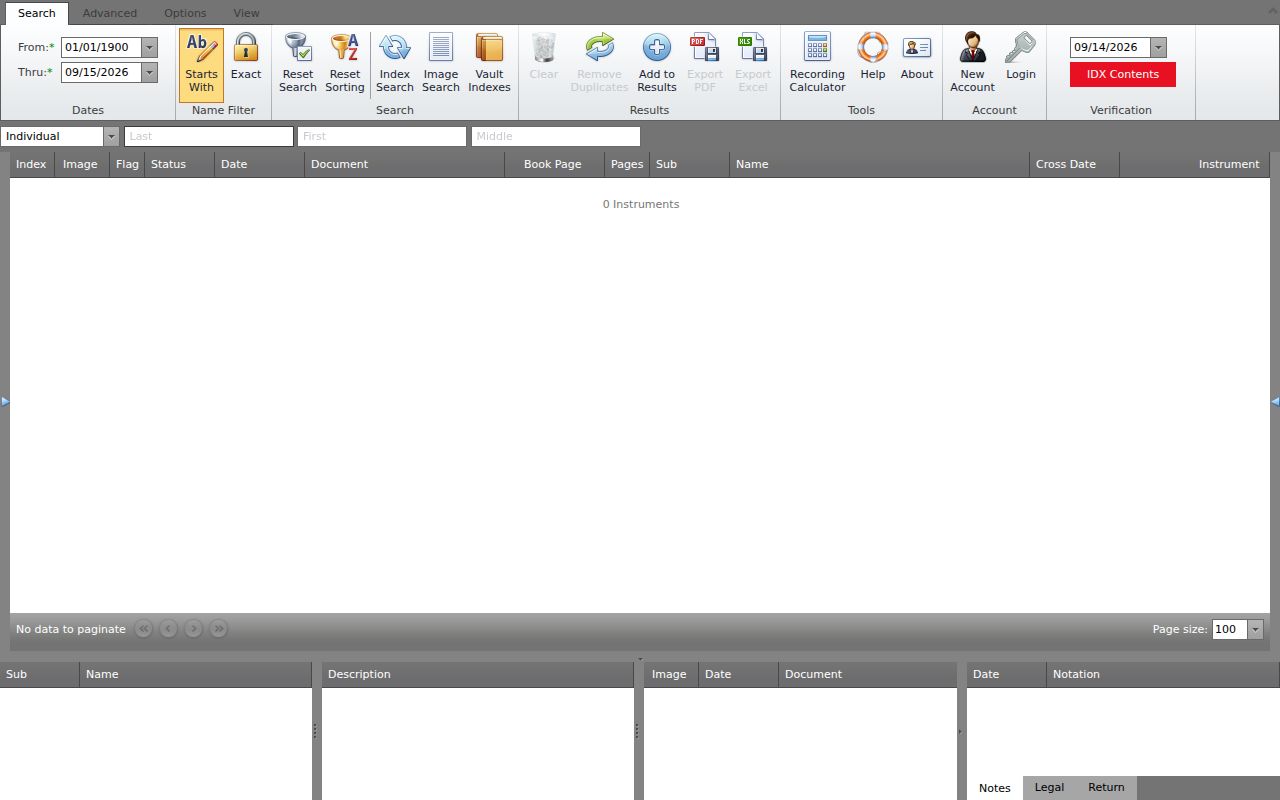
The index overview is a finding aid. Read the recorded deed itself when the parties or the land description matter. For the earliest years, local history can bolster the legal chain. Waldomore holds maps, obituaries, cemetery lists, church histories, yearbooks, photographs, diaries, and letters. Its archives require an appointment, and library databases include HeritageQuest and Fold3. Those materials can tie a name to a household or address, but the Clerk's recorded instrument remains the evidence of a conveyance.
Harrison County Surface and Mineral Accounts Split
A Harrison County parcel number is not one universal key. The Assessor's form splits the surface account into district, map, parcel, and suffix. Its example reads 03 18017100000000. The mineral search takes a separate account path. District and map/parcel information is entered without spaces. That example format is 99990123456780000. So a surface owner result can miss a mineral account. This holds even when the same surname or land is involved.
Keep surface and mineral clues apart in your notes. Search the owner-name pair first. Then try the matching parcel components. Switch to the mineral form when oil, gas, or subsurface ownership is the question. The Assessor lists a minerals contact at 304-624-8523, separate from its real-estate and homestead lines. Never treat a mineral account as a duplicate surface parcel. It is not proof that every recorded mineral interest is current either.
Owner names vary for other reasons. An LLC, trust, estate, life estate, or joint tenancy may be indexed under the entity. A fiduciary may be listed rather than an individual. A same-name match alone will not connect a person to a house. Compare the mailing address, legal description, parcel ID, and deed reference first. Only then decide two records belong together.
Note: Keep the surface account and mineral account in separate search notes. Their formats and legal interests differ.
Harrison County Value and Tax Dates
West Virginia sets annual assessment as of July 1 at 60 percent of true and actual value under Code §11-3-1. “True and actual value” is generally the amount expected in an ordinary voluntary sale, subject to special rules for income-producing property and farms. The assessed figure is the tax base, not a quote of what a buyer will pay. Harrison County assessment records separate land, building, and total appraisal fields, while the deed trail may show a recorded consideration from a particular transfer.
The calendar matters. The state says tax tickets issue on or after July 15. A valuation protest generally starts with the county commission’s Board of Equalization and Review beginning February 1; that board may adjourn after February 15 and must finish by February 28. Classification and taxability disputes follow §11-3-24a, while appeal deadlines differ by route. Keep the assessment card, sale evidence, photographs, and the notice together before contacting the Assessor or county commission.
Homestead relief is a separate tax status. West Virginia’s Tax Division describes the homestead exemption and other property-tax exemptions; an eligible owner generally files the senior or disabled homestead application by December 1. A homestead flag does not prove legal title or physical occupancy. The screenshot below points to the state’s exemption guidance, while the Harrison record remains the place to check what was applied to a specific account.
West Virginia’s Tax Division describes homestead and other relief categories. The Assessor lists homestead questions at 304-624-8540 and real-estate assessment at 304-423-7277. Compare the account’s land and improvement fields with the applicable tax year before drawing a conclusion about sale value.
The pictured guidance comes from the West Virginia Tax Division exemption page; it describes statewide programs rather than a specific Harrison account.

Harrison County's Sheriff collects property taxes. The Sheriff page hosts the live tax-ticket search link. Call 304-624-8685 with tax questions; the line routes through the Assessor office. Search fields and the delinquency layout can change, so treat the page itself as the authority. Exemptions are a separate matter. Check the local account to see whether an exemption was applied to the parcel and tax year. Each record answers a different part. A deed proves title, a tax ticket shows the bill, and an assessment card explains the valuation.
Harrison County Parcel Maps Give Location Context
The GIS hub links a Tax Parcel Viewer and a separate 911 Addressing Locator. The assessor ArcGIS service lists parcel geometry, LandHooks, rights of way, old boundary lines, districts, DistMap, TIF districts, and an IASData table. Identify and Find operations inspect or locate map features, and Export Map creates a map output. These layers tie an address to a parcel and show district context, though the county GIS is not a licensed survey.
The statewide WV Property Viewer opens on a physical address. Clicking the parcel can reveal a different mailing address, and boundaries are easier to select at about 1:18,056 scale. When parcels overlap visually, a popup lists parcel IDs to scroll through. The viewer’s identify and CSV-export help rounds out statewide parcel lookup, while the Harrison County Assessor map service supplies the county-layer context and tool names.
For older land, compare the GIS with a small or large plat, survey book, deed description, or district land book. A tax line may be generalized or out of date, and an old boundary line is historical context, not a present legal edge. For a fence, access right, or exact acreage, let the GIS guide the record search and let a qualified surveyor settle the boundary.
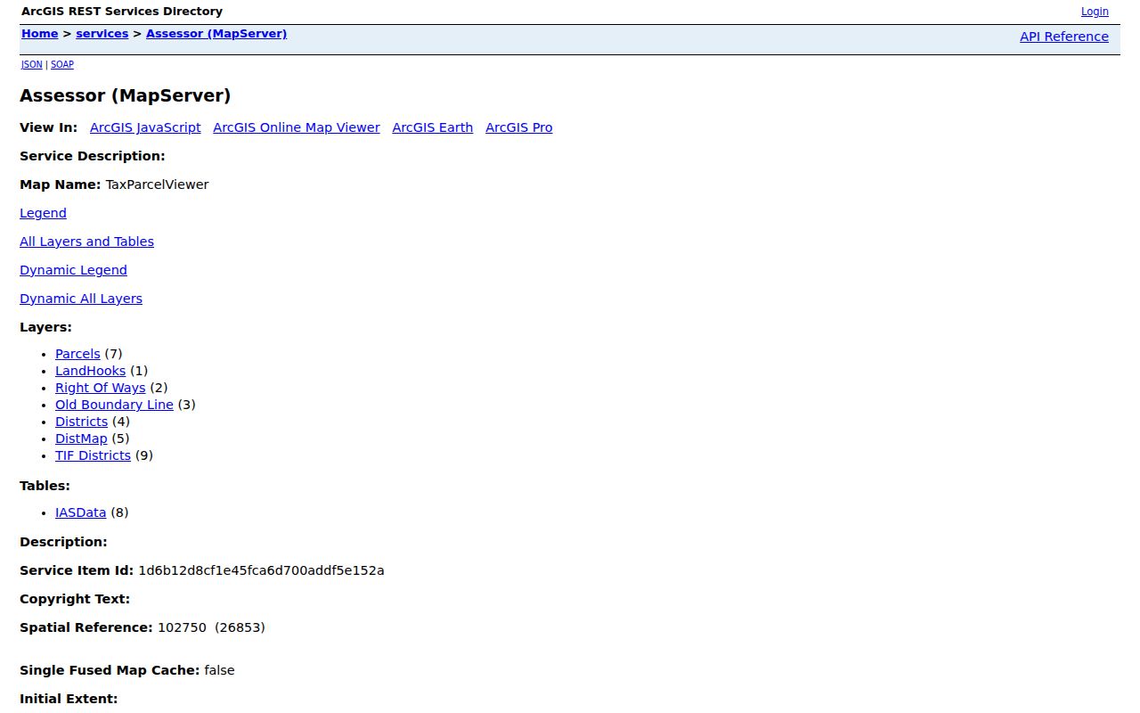
Maps locate the parcel; the deed or plat describes it.
Harrison County Clarksburg Property Records
Ownership inside Clarksburg still traces back to Harrison County. City records add a different layer: permits, inspections, zoning, floodplain, and property-maintenance history. Clarksburg handles permit applications and inspection status through Cloudpermit. After creating an account, users can schedule or cancel inspections, send time-stamped messages, submit changes, and track status. City guidance sets a 24-to-48-hour review expectation. Historic search coverage stays behind login, so plan on an account for full use.
Clarksburg Code Enforcement wears several hats. It handles building-code enforcement, zoning and planning rules, the FEMA-certified floodplain program, and MS4. Its published forms cover building permits, fee schedules, code appeals, extensions, facade requests, flood-event surveys, sidewalk closures, property-maintenance standards, rain-barrel applications, rental registration, and vacant-property registration. One caution applies. A Clarksburg mailing city can describe an address outside municipal jurisdiction, so confirm the parcel's location before relying on a city permit path.
The courthouse sits in Clarksburg, which makes the city a natural starting point for a deed chain. Neighborhood names are not parcel labels. For checking downtown, Stealey, North View, Glen Falls, Adamston, and Quality Hill, the county GIS and the Clerk's plat records are the better tools. Exact plat book and page references for those labels are not published.
Older properties have another ally. Waldomore, the local history and genealogy collection of the Clarksburg-Harrison Public Library, holds local maps, obituaries, church histories, yearbooks, cemetery listings, photographs, diaries, and letters. The 1842 house now tracks a different parcel trail. A deed can establish title. An obituary or directory can help place a family at an address, which is a clue rather than proof of ownership. Archives visits require an appointment. Research-room hours run Monday through Friday, 10 a.m. to 6 p.m.
Waldomore's official local-history page lists contact and appointment details. Staff also answer at 304-627-2236 extension 220. Email works too: waldomore@clarksburglibrary.org. Check any directory entry against the tax account and the recorded deed before treating it as ownership evidence.
Library material builds a historical lead. Then confirm ownership with the recorded instrument at the county level. Note: Confirm the parcel's city jurisdiction before treating a municipal permit as part of its property history.
Harrison County Bridgeport Property Records
Bridgeport layers its own permitting on top of Harrison County property records. The city code official reviews permit applications, amendments, site plans, variances, and interpretations. Appeals and code interpretations go to the Board of Zoning Appeals. The zoning code itself covers districts, permitted uses, planned-unit development, nonconforming uses, home occupations, subdivision rules, plat approval, and design and construction standards.
Floodplain permitting creates a documented handoff between city and county. Development, new construction, substantial improvement, or relocation requires a written permit plus a standard site plan. The Floodplain Administrator checks applicable codes and verifies contractor-license proof. The city sends permits to the County Assessor and new-structure address data to county E-911, which routes new-address requests back to the floodplain office. Bridgeport keeps floodplain records permanently in a hazard-safe location.
That chain helps when a new structure lacks a clean assessor address match. Pull the Bridgeport permit and site plan first. Then check county E-911 and the Assessor account. Simpson district land books, including the "X LAND BOOK – SIMPSON DIST – BRIDGEPORT – 1996" entry, can supply a historical cross-reference, though a district label does not fix present municipal limits. ZIP codes also follow postal routes rather than city boundaries.
The city publishes its rules on the Bridgeport zoning page. Bridgeport offers no public permit tracker with searchable fields. Without an online status search, request the record by street address and parcel number, then compare it against the county GIS map and the recorded deed.
Harrison County CourtPLUS and Land History
Harrison County dates to 1784, and its land-record menu spans both old books and modern e-filing. CourtPLUS circuit and family filing launched for Harrison on February 13, 2023. It went statewide in July 2024. Attorneys, government users, pro hac vice filers, and approved staff can file through it. The party-search fields for the public are not openly exposed. So ask the Circuit Clerk how to inspect a public case docket.
A property case might involve foreclosure or lis pendens. It might also involve quiet title, partition, lien enforcement, or an estate order. The Harrison Circuit Court clerk sits at 301 West Main Street in Clarksburg, reachable at 304-624-8640. CourtPLUS order references can be checked through the Judiciary's Verify an Order tool. A docket can explain a dispute or sale. It cannot, by itself, prove the current owner of record. So compare any order with the latest deed and tax parcel.
Paper and online sources each carry weight. The IDX index supplies a name, date, book and page, and instrument route. The court file adds case steps. Waldomore and the state archives can offer a historical name or place clue. When an online portal shows no stable sample record, a counter visit or records request fills the gap. For a certified copy, follow the custodian's current fee schedule rather than relying on a search-screen image.
Harrison County property records can show what was indexed. But the final instrument may hold details a result row omits. Read the deed, release, order, or plat itself when a particular right is at stake. A title company or attorney can review the chain for a transaction. An assessor card cannot settle an ownership dispute.
Harrison County State Record Searches
Some ownership questions point beyond Harrison County property records to a state filing. When an assessor result lists an LLC, the free West Virginia Secretary of State organization search shows its name, type, city, status, full address, creation date, and registered-agent contact. The advanced search accepts organization, agent or officer, record ID, location, entity type, and dates. Remember that a registered agent is a service contact. That person or firm does not necessarily use or own the land.
When an assessor account names a business or trust, a state filing helps confirm its legal name. It also helps confirm its contact details. A secured-transactions filing is not automatically a real-estate lien, though. Compare its collateral with the County Clerk instrument before drawing conclusions.
West Virginia Vital Registration is a separate system. It holds births and deaths from 1917 forward. It holds delayed births from about 1850. It includes marriage indexes from 1924 and marriage records from 1964. Divorce indexes start from 1967. A certified copy costs $12 and requires acceptable ID and eligibility. Birth records under 100 years old stay confidential. The County Clerk handles local marriage licensing and filings. The state issues certificates under its own access rules.
The state's certificate page spells out the request path and ID requirements. That process differs from a Harrison deed search or an open owner lookup. For family history, lean on the public older holdings and local archives. Then rely on probate orders and recorded instruments for the property transfer itself. The West Virginia Vital Registration request page is the official source for that certificate process.

Vital certificates follow their own eligibility rules. They cannot substitute for a recorded deed or an estate order. Voter inspection works differently again. West Virginia Code §3-2-30 permits inspection of certain voter fields at the county clerk. Noncommercial name lists cost one cent each. Phone numbers, email addresses, Social Security digits, and driver-license or state ID numbers stay excluded. The Secretary of State’s GoVoteWV site helps with voter information, while the county clerk holds the underlying voter file.
A separate state search shown here is the West Virginia State Police registry. That registry carries its own lawful-use rules. It is not a property ownership source. Never use it to target or contact a person.
These distinctions matter: “public record” does not mean every state database belongs in a parcel search. Start with the custodian that created the record. Then use only the fields and access route the law allows for that record.
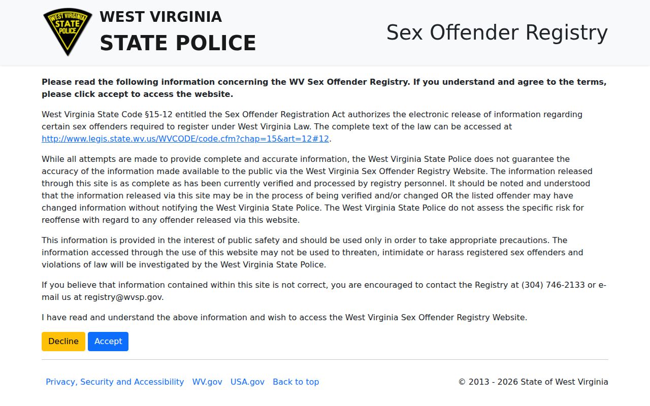
This state directory is not an owner or parcel source. Use it only for its stated lawful safety purpose.
Note: A state certificate or entity listing adds context, but it does not replace a county deed or probate record.
Limits of Harrison County Property Records
Harrison County records are strongest when independent sources line up. An assessor account shows the name used for taxation. A deed shows the grantee and legal description. A tax ticket shows any balance owed. GIS shows the parcel’s approximate location. When these disagree, look closely before doubting the record itself. The gap may be a timing issue, a spelling difference, a mineral account, a mailing address, or an estate filing rather than an error.
West Virginia’s property records support lawful research, due diligence, estate work, and civic use. They are not a title report, market appraisal, or boundary survey. Never use owner information to stalk, harass, threaten, or harm anyone. For a legal ownership question, rely on the recorded instrument and qualified title counsel. For an exact boundary, hire a licensed surveyor.
Use the source that answers the question. Harrison County public records can guide a search, but only the custodian can certify or correct its record. Verify names, dates, and parcel descriptions before relying on a result.