
How to Search Bridgeport Property Records
Ownership questions live in the county's tax parcel and deed index. City records answer something different. They show which permit, site plan, zoning review, or floodplain action touched the property. Match the street and parcel first. Only then check the city, once the parcel's municipal location is clear. The Harrison County property search page walks through the county lookup fields in plain terms.
- Use the county assessor to match the street address to a parcel ID.
- Check the recorded deed or plat through the County Clerk when ownership or lot layout matters.
- Ask the Sheriff or Assessor about the tax year or bill field.
- Open county GIS to compare the parcel and its district context.
- For a parcel under Bridgeport jurisdiction, ask the city about zoning, permits, or floodplain files.
This short route keeps you from mistaking a city permit for a deed. It also stops a city label from standing in for a legal boundary. Bridgeport property records only line up across both offices when the references point to the same parcel.
Bridgeport Zoning and Permit Custody
Bridgeport's code official handles building permits and amendments, site plans, variances, and interpretations under §1305.02. Interpretations and appeals go to the Board of Zoning Appeals. The Planning and Zoning code covers district and use rules, planned-unit development, nonconforming uses, home occupations, subdivision regulation, plat approval, and design and construction standards.
City Hall sits at 515 W. Main Street, Bridgeport, WV 26330, telephone 304-842-8200. The municipal file can add permit, inspection, zoning, and site-plan detail to a county parcel. The city publishes no public permit tracker or searchable field list. So a records request should carry the exact street address and county parcel number.
County offices still anchor ownership. A city review can reveal which development rules applied. But it never changes the recorded owner of record or the tax roll account. Ask the city directly which office or code official holds the permit or zoning record. Ask which official holds the zoning record you need.
Note: Bridgeport code review covers municipal work. The county deed remains the recorded source of ownership.
Bridgeport Places and Plat Context
Place names make handy map lenses for Bridgeport property records. They are not legal subdivision claims. The county Clerk's plat books, large and small, confirm a tract before any place name earns your trust. Treat neighborhoods as starting points, not boundaries.
| Place or record lens | Era detail | Use in the search |
|---|---|---|
| Main Street corridor | 2023 reconstruction noted; plat era not verified | Compare city plans with county parcel and deed |
| Airport / eastern development | Specific plat dates not verified | Check site plan and municipal zoning records |
| Charles Pointe context | Master-planned community context; exact plat refs not captured | Confirm lot and block in recorded plat files |
| Simpson District | Land-book entries include 1996 example | Historical cross-reference, not city-limit proof |
Bridgeport property records can sit under Simpson District. That can surprise people who think in terms of a modern neighborhood. The county IDX menu includes an "X LAND BOOK – SIMPSON DIST – BRIDGEPORT – 1996" entry. It also lists Simpson district and outside books. That label helps you pick a record family. It does not define current city limits or a specific Charles Pointe lot.
No complete ZIP-line map, annexation chronology, or exact plat references exist for these areas in one place. Use USPS for postal geography. Use county GIS plus the recorded plat for property identity. ZIP codes and city limits are different geography entirely.
Bridgeport Floodplain Permits Reach the Assessor
Bridgeport's floodplain code builds a practical cross-office trail. Under §1731.07, development, new construction, substantial improvement, or relocation requires a written permit. A standard site plan is required too. The Floodplain Administrator checks other applicable codes and verifies contractor-license proof where required. These papers show why a parcel near a watercourse drew review. A permit file is still not a deed, and it proves nothing about flood insurance.
The city must copy permits to the County Assessor. Permits for new structures also go to county E-911. E-911 routes new-address requests back to the Floodplain Administrator. Bridgeport keeps floodplain records permanently in a hazard-safe location. A new structure or street number may lag in the assessment search because of that handoff. Follow the trail instead of assuming the record is missing.
The floodplain permit code lives in the municipal code library. The city publishes no searchable permit form online, though. Request the permit by address and parcel. Request the site plan the same way. Then compare them with the county tax account and GIS location. The city zoning page is one public starting point. The code official is the other. Either one helps with a Harrison County property records question that touches a floodplain.
Bridgeport Zoning Review and Site Plans
Zoning questions leave a different paper trail than building permits. A parcel's use, proposed work, or site layout may go through municipal review. Then the city file may hold a site plan. It may also hold a variance application. Ask Bridgeport about Board of Zoning Appeals materials too. Notice, minutes, and written decisions can also sit in that file. Together they explain how the city treated a particular proposal. The deed and recorded plat still carry ownership and the legal parcel description. Treat zoning paper and title paper as separate evidence.
When you contact the city, give the street address and the Harrison County parcel ID. Add an approximate project date if you know one. The public zoning resource is a solid entry point for municipal rules and contact details. Bridgeport publishes no searchable permit or zoning-history database. A blank online result proves nothing about whether review occurred. Ask the custodian directly which records exist and how to request them.
Note: Keep zoning decisions, county assessment data, and recorded title documents separate for the same property.
Bridgeport Permit Search Fields Are Not Public
Bridgeport publishes no public permit tracker or field inventory. That gap matters. Do not expect an online address search, permit-history export, or status page. The city's zoning page does offer general code information and contact details. For a specific project, hand the city the street address and county parcel ID. Then ask which custodian holds the file.
| Permit tracker | No public searchable tracker was confirmed. |
|---|---|
| Field list | No public address, owner, or permit-number search fields were verified. |
| City contact | Bridgeport zoning page lists 304-842-8200 and City Hall address. |
| Records request | Request permit, site plan, floodplain, or zoning file by parcel and street. |
Bridgeport's official zoning resource is not a searchable permit database. It is the dependable starting surface for municipal zoning rules and city contact details. Visit Bridgeport's official zoning page to see what the city posts.
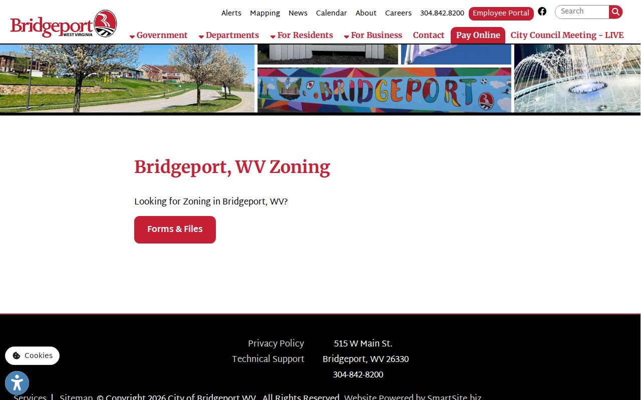
Use the zoning page for municipal rules and contact details. It is not a public permit-search database.
The city may keep its records off the web. West Virginia FOIA still supports a request for a specific public record. Name the address, parcel, file type, and approximate period. The custodian must respond within the statutory time frame. A description that is too broad may draw a request for clarification, and nothing moves until it is settled.
Note: With no public field list, ask the city directly about the file and its custodian.
Bridgeport Addressing and County Parcels
A new structure can open a timing gap. The gap sits between the city permit, the E-911 address, and the assessor account. The city's code sends permit details to the County Assessor. New-structure address requests go to E-911. That lag is a concrete reason to search by parcel components. Do this when a street name returns nothing. Check the county 911 Addressing Locator alongside the Tax Parcel Viewer. Then ask Bridgeport about the permit record itself.
Keep physical address, mailing address, and legal description separate. The WV property viewer shows the physical address first. Parcel detail may list a different mailing address. A tax account can be keyed by district, map, parcel, and suffix. Treat the Simpson district book as a historical clue. It is not a crosswalk that proves a current city address.
Bridgeport Property Records and Value Context
Bridgeport’s July 1, 2025 population estimate was 9,427, compared with 9,336 at the 2020 Census. City population context does not establish value for a specific parcel. West Virginia assesses property at 60 percent of true and actual value as of July 1. For a property, compare the Assessor’s land, building, and total fields with the recorded deed consideration and tax year.
The 2023 Main Street reconstruction was described in 2026 comprehensive-plan material as a reinvestment project valued above $300,000. That amount describes the project context, not an increase in any nearby home value. Use the value only to understand a public investment and verify a parcel’s assessment and sale records on their own.
Bridgeport District Names and Older Records
Simpson district runs throughout the Harrison index. It acts as a bridge between older land books and the city name. When a modern street or subdivision name falls short, search the Clerk's book selector by district and year. Harrison's broader book list names land books, deed books, plats, surveys, road records, liens, and reports of sale. Bridgeport subdivision book and page references are not pinned down here. So let the district selector shape your next question rather than replace the instrument itself.
Older records may describe a lot by survey, adjoining owner, or metes-and-bounds calls. A current GIS parcel can help you locate the tract. Only the legal description and recorded plat tie it to the deed chain, though. If the line or municipal status matters, request both the county record and the city zoning record. Use both for the same parcel.
Note: A Simpson district book label can guide an index search without proving present city limits.
Limits on Bridgeport Property Records
County deeds and assessments establish the property-record route. City permit and floodplain files add municipal context. None alone proves a boundary, market value, or current title. A district name, mailing city, or nearby waterway is never a legal parcel edge. Confirm any record with the office that created it.
Use Bridgeport property records for lawful due diligence, building history, floodplain review, and civic research. Never use an owner name or address to harass, threaten, stalk, or harm someone. For exact boundaries, rely on a licensed surveyor. For a title question, turn to the recorded instruments and qualified title review.
Permit access is limited. The research did not confirm a public Bridgeport permit search. Ask the city for a specific file by address and parcel instead of assuming online fields exist.